
Join us and act against climate change! Learn how you can get involved.

MEMBER LOG IN
DONATE
Green umbrella Logo
  • What We Do
    • Our Work
    • Our Mission
    • Our Region
    • Our Impact
  • Our Team
  • Our Programs
  • Events
    • Events Calendar
    • Midwest Sustainability Summit
    • Cincinnati Climate Week
  • Resources
    • Member Directory
    • Green Jobs Board
    • Get Outdoors
    • Reports & Tools
    • Stories & Announcements
  • Get Involved
  • Search

Landen-Deerfield Park

September 10, 2025 by Claire Carlson

Tucked away in the heart of the Landen-Maineville area lies a 95-acre hidden gem with connections to the Little Miami River, offering opportunities for mountain biking, outdoor recreation, and fishing. You won’t want to miss out on exploring this park!

Join the Warren County Park District, the Cincinnati Off-Road Alliance (CORA), and Green Umbrella’s Greenspace Alliance for the Meet A Greenspace Hike at Landen-Deerfield Park on Friday, September 19, from 3:00-4:30 pm.

A Community Hub

Image source: CORA

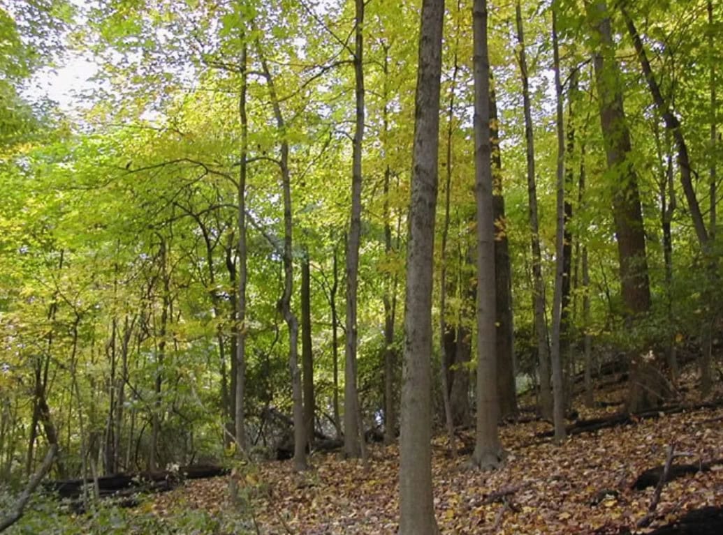
Landen-Deerfield Park lies in the heart of the Landen-Maineville area. The sprawling 95-acre park offers a variety of recreational options, including approximately two miles of hiking and mountain biking trails. The northern portion of the park is home to Simpson Creek, a local hidden gem. This area of the park offers nature enthusiasts the chance to escape bustling suburbia and settle into a serene space surrounded by babbling water and chirping birds. It is the perfect place to seek respite and reconnect with yourself and nature.

Work to restore the water features at the park is currently underway – read on to learn what is happening!

Re-imagining Waterways through Restoration
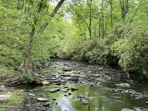
Image source: Warren County Park District

The Warren County Park District is the recipient of a nearly $1 million investment focused on improving water quality, nature play and recreation, nature education, public safety, and long-term maintenance. Known as the Simpson Creek Headwaters Restoration Project, this investment will assist in restoring a tributary of the Little Miami River near Simpson Creek. This will also revitalize a beloved water feature, the Landen-Deerfield Park Pond, to a natural stream channel with wetlands and a pond system. These changes will help improve water quality in the Little Miami River Watershed.

The project, scheduled to begin in the latter half of 2025, is designed to establish natural waterways at the park by reducing the size of the pond. Historically, this pond never existed in this location and was created by the damming of a stream in the 1980s. While the pond is a popular spot for anglers today, it is an unhealthy water body due to its shallow depth, the depletion of oxygen from the growth of algae, duckweed, and watermill, and the subsequent influx of chemicals designed to “treat” the unwanted aquatic plant growth.

Long term, this project will be able to improve wildlife and fish habitats, establish natural streams, wetlands, and stream edges that will be more effective at removing pollutants from local waterways, increase accessibility for park-goers to interact with the water, and reduce downstream flooding risks and maintenance costs for the dam.

Reimaging Trails
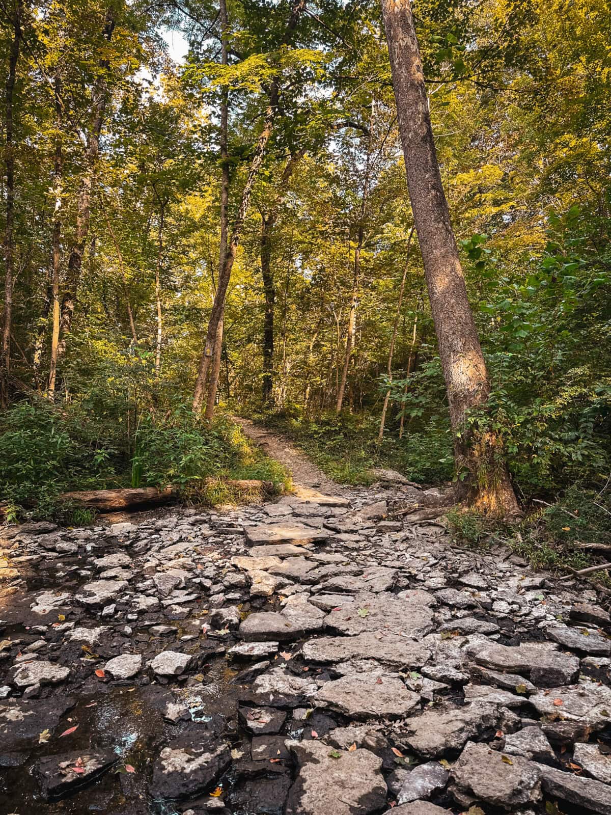
Image source: CORA

One of Warren County Park District’s partners is the Cincinnati Off-Road Alliance (CORA). CORA was founded in the 1990s by a group of dedicated mountain bikers in Greater Cincinnati who had trouble finding trails for singletrack mountain bike use. CORA focuses on building and advocating for more miles of sustainable, off-road trails. Warren County Park District and CORA work together to provide community members with access to nature.

Today, CORA maintains over 115 miles of multi-use natural surface trails throughout the region, including 3.5 miles of trails at Landen-Deerfield Park.

Explore Landen-Deerfield Park!

Join us for this unique outdoor experience with the Warren County Park District! The hike will take place on Friday, September 19, from 3:00-4:30 pm at Landen-Deerfield Park and will be guided by Warren County Park District and CORA staff. We will meet at the Trailhead Shelter at the back of the park by the bit arch. The park’s address is 2258 US-22 in Maineville, OH, 45039.

This hike is part of our monthly Meet a Greenspace Hiking series. We hope these hikes will provide those who join the time and space they need to reconnect with nature. If you have any questions, contact Green Umbrella’s Greenspace Alliance Manager Claire Carlson at claire@greenumbrella.org.
Filed Under: Greenspace Alliance, Meet A Greenspace Hike Series

Scientists in the Wild

August 5, 2025 by Claire Carlson

Have you ever dreamed of meeting a scientist in real life? How about exploring a hidden greenspace? If either of these statements rings true to you, join the Greenspace Alliance, Cincinnati Parks, and the Center for Collaboration on Climate and Community for Health (C4H) for their Meet A Greenspace Hike at Badgley Run!

Join the Greenspace Alliance and C4H for this month’s Meet A Greenspace Hike on Friday, August 29, from 3:00-4:30 pm at Badgley Run in Cincinnati’s Northside Neighborhood.

Hidden Gems

Once slated for development as part of the I-74 expansion, Badgley Run is a 16-acre property owned and operated by the Cincinnati Park Board (CPB). Local community members successfully advocated for its protection. Initial funding acquired the original two parcels of land, and a comprehensive restoration initiative remediated extensive dumping, erosion, and invasive species on the site. The park is currently managed by Cincinnati Parks, along with Northside Greenspace Inc. and other regional stakeholders who are committed to improving the site.

To further highlight the success of this property, Badgley Run serves as an important greenspace corridor for both wildlife and residents. At the time of its initial purchase, Badgley Run aligned with the City of Cincinnati’s goal to link the Northside communities with nearby Mt. Airy Forest. Additionally, a property owned by The Hillside Trust, a non-profit dedicated to protecting the region’s hillsides, borders Badgley Run, further emphasizing its importance as a greenspace corridor.

C4H: Connecting Climate and Health in Cincinnati

The Cincinnati Center for Collaboration on Climate and Community for Health is a new research center under development at the University of Cincinnati. Often referred to as C4H, the Center will focus on understanding and reducing the health impacts of climate change on vulnerable populations, including first responders, outdoor workers, pregnant women, children, and senior citizens living in economically disadvantaged urban areas. As climate change continues to worsen, cities and the urban and suburban sprawl that forms around them will be subject to its impacts at higher levels. These communities often lack natural features like forests and native greenspaces that help mitigate the impacts from heat, air pollution, and storm events that are becoming more prevalent and extreme.

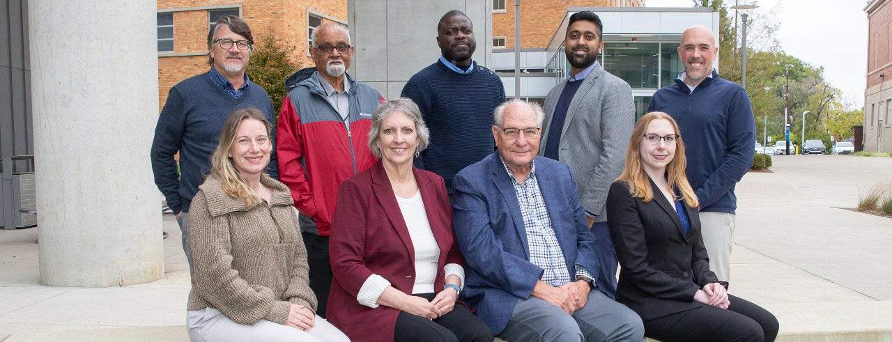
Leadership of the new Cincinnati Center for Climate and Health. Photo/Andrew Higley/UC Marketing + Brand. Seated from left to right: Kelly Brunst, PhD, Ardythe Morrow, PhD, MSc, George Leikauf, PhD, Michelle Burbage, PhD. Standing from left to right: David Stradling, PhD, Amit Bhattacharya, PhD, Angelico Mendy, MD, PhD, Shaunak Sastry, PhD, Patrick Ryan, PhD, MS.

This Meet A Greenspace Hike will connect participants with scientists working to protect human health in a changing climate. Representatives from C4H will share how their work impacts individuals on both regional and national scales. This hike will also offer hikers the opportunity to communicate concerns they have about the intersection of health and climate change.

Explore Badgley Run!

We hope you’ll join us at our upcoming hike with Cincinnati Parks and C4H! The hike will take place on Friday, August 29 from 3:00-4:30 pm. It will be guided by staff from Cincinnati Parks along with members of C4H. We will meet at the Badgley Rd. entrance, located at 4300 Badgley Rd., Cincinnati, OH 45223.

This hike is part of our monthly Meet a Greenspace Hiking series. We hope these hikes will provide the time and space they need to reconnect with nature. If you have any questions, contact Green Umbrella’s Greenspace Alliance Manager Claire Carlson at claire@greenumbrella.org.

Filed Under: Greenspace Alliance, Meet A Greenspace Hike Series

Deep Space, Land Preservation, and…Orienteering?! Find them all in Warren County, Ohio!

July 14, 2025 by Claire Carlson

Contributors: Claire Carlson

Known as the “jewel of the Little Miami River Valley”, Hisey park is an oasis in southwest Ohio. Full of history, hiking trails, and even a Rocketry Association, this park has it all!

Join the Warren County Park District and Green Umbrella’s Greenspace Alliance for the Meet A Greenspace Hike at Hisey Park on Friday, July 18 from 3:00-4:30 p.m. Enjoy a meandering hike and an opportunity for solar viewing with the Warren County Astronomical Society at the Fred Bay Observatory in Hisey Park!

The Journey West

Graphic source

Like many families who came to America in the 17th century, the Hiseys traveled far and wide before settling in the Little Miami River Valley. Their journey began out east in Truro, Massachusetts, with stops in North Carolina and Kentucky, before moving to the new state of Ohio in the early 1800s. From 1809 to 1988, generations of the Hisey family farmed the land that would one day become Hisey Park. They planted corn, wheat, and soybeans, and raised livestock, including horses, sheep, hogs, and cattle. As the family grew, so did the farmhouse. It started as a small home made of logs and expanded into a two-story building where the last generations of the Hisey family lived before moving to a larger farm in Greenfield, Ohio in 1998.

To this day, the farmhouse remains on the property. Its simple frame and exterior is an ode to a different time; a time when cultivating the land and cultivating one’s family was of the utmost importance. While the house is not open to the public, the Warren County Park District uses it for various programs and events.

The Legacy of the Hisey Name

Graphic source

If the original members of the Hisey family were still alive today, their legacy might suprise them. Not only is the land they stewarded permanently protected, it is also home to and used by a number of organizations within Warren County.

Located near the house is a cylindrical structure appearing to stick out of the ground. Its silver color and corrugated surface looks like a standard grain silo – a typical feature of a farmyard. However, this structure holds no grain and is a special silo known as the Fred Bay Observatory. The Observatory features a 9-inch refracting telescope that allows visitors to view the solar system’s planets and deep-space phenomena like galaxies, nebulas, clusters, and stars. During the hike on July 18, the Warren County Astronomical Society (WCAS) will open the Observatory and provide solar viewing to hike participants!

In addition to WCAS, representatives from Friends of Warren County Park District and Orienteering Cincinnati will be joining us for the hike! Meet A Greenspace Hikes are designed with this type of connection-building in mind, and hiking with us will help you learn more about what each of these organizations do and how you can get involved!

Explore Hisey Park!

Join us for this unique outdoor experience with the Warren County Park District! The hike will take place on Friday, July 18 from 3:00-4:30 pm at Hisey Park and will be guided by Warren County Park District Staff. We will meet at the picnic shelter off of the parking lot at 5443 Middletown Road, Corwin, OH 45068.

This hike is part of our monthly Meet a Greenspace Hiking series. We hope these hikes will provide those who join the time and space they need to reconnect with nature. If you have any questions, contact Green Umbrella’s Greenspace Alliance Manager Claire Carlson at claire@greenumbrella.org.

Filed Under: Greenspace Alliance, Meet A Greenspace Hike Series

Building Trails to Foster Community

June 2, 2025 by Claire Carlson

Contributors: Claire Carlson, Jaki Howser

Situated on the southern edge of Dayton, Kentucky, this greenspace has been transformed into a multi-purpose, natural-use trail system for the community.

Join the Cincinnati Off-Road Alliance (CORA) and Green Umbrella’s Greenspace Alliance for the Meet A Greenspace Hike with CORA on Friday, June 20th, from 3:00-4:30 PM.

Sargeant Park: A Brief History

For a number of years, Sargeant Park in southern Dayton, Kentucky was reclaimed by nature. Plants, invasive and otherwise, grew tall and thick, overtaking much of the forest floor. Woodland creatures made homes in the 40 acres of overgrown trees and plentiful vegetation. Some species, however, did not thrive. As the Emerald Ash Borer beetle left a trail of destruction in its sweep across the country, the once-plentiful ash tree deteriorated, died, and fell in Sargeant Park. Beginning in the early 2020s, the City of Dayton and its Park Board began the process of restoring this park to breathe new life into it. This work has continued over the past four years, with the park recently being reopened for public use and enjoyment.

Reimagining Trails

A main partner in this work to reinvigorate and reimagine a community with an accessible and usable Sargeant Park is the Cincinnati Off-Road Alliance (CORA). CORA is a non-profit organization focused on building and advocating for more miles of sustainable, off-road trails.

Today, CORA maintains over 115 miles of multi-use natural surface trails throughout the region, including those at Sargeant Park. They began trail construction at the park in the fall of 2024 and wrapped up construction in the spring of 2025. CORA and its partners at the City of Dayton, the Dayton Park Board, Groundwork Ohio River Valley, Northern Kentucky University, and countless volunteers have poured hours of labor and dedication into transforming this once forgotten and neglected space into a place to be enjoyed by the community.

Explore Sargeant Park!

CORA’s dedication to providing accessible and sustainable trails for all is truly exemplified by its work in Sargeant Park. We hope you will be able to join us in celebrating their hard work by getting out and exploring the newly developed trail system! The hike will take place on Friday, June 20, from 3:00-4:30 PM at the Sargeant Park and will be guided by CORA staff. We will meet in the parking lot at 999 Covert Run Pike, Dayton, KY, 41074.

This hike is part of our monthly Meet a Greenspace Hiking series. We hope these hikes will provide those who join the time and space they need to reconnect with nature. If you have any questions, contact Green Umbrella’s Greenspace Alliance Manager Claire Carlson at claire@greenumbrella.org.

Filed Under: Greenspace Alliance, Meet A Greenspace Hike Series

“Grossly Polluted” to Revitalized: Visit the Mill Creek

April 1, 2025 by Claire Carlson

Contributors: Claire Carlson, Beth Himburg

Once a thriving waterway, then being polluted by humans and labeled “the most endangered urban river in North America”, then restoring it to a healthy water body, there have been many transitions throughout the life of Mill Creek. Come and explore one of the largest stream restoration projects in SW Ohio!

Join the Mill Creek Alliance and Green Umbrella’s Greenspace Alliance for the Meet a Greenspace Hike with Mill Creek Alliance on Friday, April 18 from 3:00-4:30 p.m.

A Journey Through the Waters of Time

Originally called the Maketewa by the Shawnee peoples who called this region home, the creek was once a source of sustenance. By the late 1700s, settlers began to arrive, renaming the waters Mill Creek, and in 1791 the first mill was constructed along the creek in Northside. As the population expanded and the Industrial Revolution boomed, bridges were built, canals dug, and sewage began being dumped into the Creek. As human growth pushed forward, wildlife in the creek waters disappeared, and factory and sewer waste transformed the once clean water into a “grossly polluted” waterbody that could no longer sustain life. During the Green Revolution of the early 1970s and subsequent introduction of the Clean Water Act, industries began to stop discharging waste into the Creek. Projects including the Rivers Unlimited Mill Creek Restoration Project and newly formed groups like the Mill Creek Watershed Council and the Mill Creek Yacht Club began their revitalization efforts in the mid to late 1990s, laying the foundation for what the Mill Creek Alliance is today.

The Healing Journey

Over the past 25+ years, the Mill Creek Alliance has worked to revitalize these waters to their once pristine state. They have implemented nearly 30 major restoration projects, with one of the largest being their Twin Creek Wetland Enhancement Project.

Graphic source: Mill Creek Alliance

Installed in 2012, the Twin Creek Preserve (TCP) Project set out to achieve full water quality attainment with Warm Water Habitat Aquatic Life Standards. These standards are designed to protect productive warm water aquatic communities, fowl, animal wildlife, arboreous growth, and agricultural and industrial use. Adherence or nonadherence to these standards is based on how much pollution is discharged into a water body. To achieve these standards, restoration on segments of the Mill Creek mainstem and East Fork Mill Creek needed to be employed.

The 5-acre Twin Creek Preserve wetland was designed to have flow from both the Mill Creek and East Fork Mill Creek whenever each stream increased in elevation. When this happens, excess water will be stored and filtered through the vegetation planted in the wetland, rather than continuing downstream. Wetlands serve important functions in an ecosystem, trapping and slowly releasing surface water, rain, snowmelt, and flood waters, reducing flood heights and erosion. Additionally, because of the numerous plants that reside in wetlands, they can enhance water quality by filtering out pollutants.

A few years after the project was completed, Twin Creek Preserve was listed as an “eBird Hotspot” in Ohio, as wetland birds such as herons, ducks, geese, and osprey frequent the lush area. Additionally, sampling done by the Midwest Biodiversity Institute has indicated large improvements in the water, biological, and habitat quality.

Explore the Mill Creek!

The Mill Creek Alliance has worked tirelessly for the past 25 years to bring life back to this once-thriving creek. We hope you’ll join us in celebrating and experiencing these accomplishments at our upcoming hike with Mill Creek Alliance! The hike will take place on Friday, April 18 from 3:00-4:30 pm at the Twin Creek Preserve and will be guided by Mill Creek Alliance staff. We will meet in the parking lot at 12033 Best Place, Sharonville, OH 45241.

This hike is part of our monthly Meet a Greenspace Hiking series. We hope these hikes will provide those who join the time and space they need to reconnect with nature. If you have any questions, contact Green Umbrella’s Greenspace Alliance Manager Claire Carlson at claire@greenumbrella.org.

Filed Under: Greenspace Alliance, Meet A Greenspace Hike Series

Urban Cows, Regenerative Agriculture, and Good Ol’ Hiking Trails

March 18, 2025 by Claire Carlson

Contributors: Claire Carlson, Jack Stenger

Have you ever met an urban cow? They are just like any other cow, except they live within city limits and enjoy beautiful views of downtown. If you’re curious to learn more about urban cows and the farm they call home, keep reading.

Join Cardinal Land Conservancy and Green Umbrella’s Greenspace Alliance for their collaborative hike at Bahr Farm and Winton Preserve on Friday, March 21 from 3-4:30 PM.

The Story of Bahr Farm and Winton Preserve

Tucked away in Northside is Bahr Farm, a 39-acre property purchased by the Bahr Family in 1916. In 2021, the Bahr Family generously gifted the farm to Cardinal Land Conservancy in exchange for permanent protection from development, which resulted in a win for the family and the creation of the Conservancy’s first working farm. Fun fact: The barn on the property was built in the early 1800s, making it the oldest barn in Hamilton County!

The working farm is home to a small number of urban cattle and Our Harvest Cooperative. The cattle are spend their time grazing on the mix of pollinator-friendly plants throughout the property, which serves as their main feed source. Our Harvest Cooperative, a local Community Supported Agriculture (CSA) and member of Co-Op Cincy, occupies 6 acres near the front of the property. The organization’s mission is to ensure that Cincinnatians have fresh, easy-to-access food grown by fairly compensated workers. If you’re interested in Our Harvest, want to join their CSA, or want to support their work, check out their website.

Bahr Farm is connected to Winton Preserve, a 19-acre wooded area east of the farm and owned by Cardinal Land Conservancy. Winton Preserve contains native trees and vegetation restored to its natural state after extensive invasive honeysuckle removal. The Cardinal Land Conservancy is working in this space to establish a trail system for public use.

Bahr Farm’s Future

Cardinal Land Conservancy plans to turn Bahr Farm and Winton Preserve into its flagship property and open it up to the community so they can learn more about urban agriculture and restoration practices. Additionally, the woods that make up the Preserve are part of a carbon credit program. This program enables individuals or companies to offset their carbon emissions by purchasing credits from an organization implementing environmental practices that directly contribute to carbon dioxide removal.

Visit Bahr Farm and Winton Preserve!

We hope you’ll join us for our upcoming hike with Cardinal Land Conservancy at their Bahr Farm and Winton Preserve properties! The hike will take place on Friday, March 21 from 3-4:30 PM, and will be guided by Cardinal Land Conservancy staff. We will meet in the parking lot at 973 W North Bend Rd., Cincinnati, OH.

This hike is part of our monthly Meet a Greenspace Hiking series. We hope these hikes will provide those who join the time and space they need to reconnect with nature. If you have any questions, contact Green Umbrella’s Greenspace Alliance Manager, Claire Carlson, at claire@greenumbrella.org.

Filed Under: Greenspace Alliance, Meet A Greenspace Hike Series

Hike Outside Your Comfort Zone

February 18, 2025 by Claire Carlson

Contributors: Claire Carlson, Josh Torbeck

Dust off your outdoor gear and join us for a winter hike at Clingman Park! This month’s hike is an opportunity to explore nature even in chilly conditions. Join us in stepping (literally) outside your comfort zone for a wintery hike!

Join the Clermont Park District and Green Umbrella’s Greenspace Alliance for the Clingman Park Winter Hike on Friday, February 21 from 3-4:30 p.m.

Hidden Gems

Parks are vital community hubs. Parks are meant to be welcoming to us all, whatever our state of mind. Whether you’re in the mood to exercise, relax, explore, or play, park districts give you the space to choose the experience you want.

Enjoying Every Season

Graphic source: Clermont Park District Facebook

Although parks tend to be busiest when the sun is shining and the day is warm, you can still find magic even when conditions are dreary. Grabbing a rain jacket and boots during a wet spring day for a visit to the park can be a peaceful experience. In the late fall, as the winds grow colder and the days get shorter, find yourself in a drift of leaves cascading from trees, providing an immersive experience of the changing seasons. Winter’s cold and dark months provide unique opportunities to observe wildlife. While walking through a park on snowy days, you can find deer tracks and footprints from small mammals. If you’re lucky, you might even spot wing prints from a falcon as they dove to the ground to catch their next meal. On a cold day, feeling the warmth of the late afternoon sun can replenish your body with much-needed vitamin D and fresh air.

The Clermont Park District

The Clermont Park District is on a mission to preserve these experiences and the greenspaces that contain them. Clermont County, along with many communities in the region, is undergoing rapid growth and development. They currently have ten properties and are looking to further expand their footprint. Stay tuned for an educational exhibit celebrating their parks in the coming year!

Explore Clingman Park

We hope you’ll join us at our upcoming Clingman Park Winter Hike! The hike will take place on Friday, February 21 from 3-4:30 p.m. and will be guided by staff from Clermont Park District. We will meet in the parking lot at 2155 US Hwy 50, Batavia, OH 45103, which is also where Clermont County Park’s administrative and naturalist offices are located.

NOTE: If you are using Apple Maps to guide you, you might be taken to Pattison Park or Stonelick Township Cemetery instead of the park. We recommend using Google Maps OR as you’re on Hwy 132 heading to Owensville, take a left on Benton Rd. and then a right on US 50. Clingman Park will be on your left after ~.25 miles.

This hike is part of our monthly Meet a Greenspace Hiking series. We hope these hikes will provide those who join the time and space they need to reconnect with nature. If you have any questions, contact Green Umbrella’s Greenspace Alliance Manager Claire Carlson at claire@greenumbrella.org.

Filed Under: Greenspace Alliance, Meet A Greenspace Hike Series

Land Through Time: A Story of Ecological Succession

January 8, 2025 by Claire Carlson

Contributors: Claire Carlson, Kelly St Charles, and Kenton County Conservation District Director Matt Wooten

Take a break from hibernation, put on your boots, and immerse yourself in the rolling hills of Northern Kentucky! This month’s hike features land returning to a wild state after being home to dairy cows. Join us and bear witness to the ecological succession of a landscape on a journey from its wild roots to farm and now conservation.

Join the Kenton County Conservation District and Green Umbrella’s Greenspace Alliance for the Morning View Heritage Area Winter Hike on Friday, January 17th from 3-4:30 p.m.

We hope to see you there!

The Origin Story

In 2010, the Kenton County Conservation District (KCCD) worked with the Kentucky Land Heritage Foundation to purchase the Morning View Heritage Area (MVHA) property to protect it in perpetuity. Before this designation, six generations of the Steinhauser family stewarded the land for 154 years, where they did everything from raising families and dairy cows to opening a store and service station for the community.

The Story of the Land

Left to its own devices, even a land cultivated for years by our hands will hold only remnants of humanity as the trees grow taller and the grass thicker. Trying to survive, humans cut down trees, planted crops, and built a homestead to support their families. But that break in the wild lasts only as long as the human hands are there to tend to it, or else it will be overtaken once again. That’s the funny thing about Mother Nature – she lets you believe you can win. 

The Morning View Heritage Area is a perfect encapsulation of the wild reclaiming its space. This process, the evolution of a biological community, is called ecological succession. There are two kinds of ecological succession: primary and secondary. Primary succession occurs in environments where soil previously incapable of sustaining life develops an ecosystem over time (e.g., a lava field developing into fertile soil). Secondary succession occurs in environments where a previously existing community was removed (in the instance of MVHA, a dairy farm).

Graphic source: geeksforgeeks.org

The presence of multiple secondary succession stories documented by the land is why MVHA is unique. When you visit the property you can see the mature forest canopy of undisturbed areas and alongside early succession areas marked by cedar and box elder trees. Invasive species like Multiflora Rose and Autumn Olive have filled in spaces that were once cattle pastures and mark the relatively recent disturbance of the land. This environment makes the MVHA a prime location to showcase how different conservation practices can support various phases of succession.

Stewarding the Land with KCCD

In addition to restoring the land, KCCD uses the property to run ecological experiments. In one experiment, three areas will be identified: one to be treated with herbicide to kill off invasive plants present and then left alone to see what sprouts from the soil; a second area treated with herbicide and then sown with a seed mix; and a third area left alone to use as a control. This type of experimentation will not only help KCCD learn about the MVHA property but will also help them to serve other landowners who may have similar succession stories on their properties.

Located near the banks of the Licking River, the property features even more opportunities for study and observation. This past summer, they conducted a recreational mussel inventory in the River and found 26 species of mussels, including a thriving population of the federally endangered fanshell mussel!

Additionally, KCCD provides technical assistance, educational opportunities, and outreach to Kenton County residents. Their work includes helping with grant administration, watershed planning, forest, prairie management, and pond workshops. In the coming year, they are working to restore a 2-acre forested property in Elsmere and look to expand their work into the world of urban gardens.

Explore Morning View Heritage Area

If you’re interested in leaving your cave of hibernation, we hope you’ll join us at our upcoming Morning View Heritage Area Winter Hike. The hike will take place on Friday, January 17 from 3-4:30 p.m. and will be guided by staff from Kenton County Conservation District. The hike will follow a 1.5-2 mile loop and feature conversations on their restoration efforts, the local history, and future plans. We will meet in the parking lot at 15168 Decoursey Pike, Morning View, KY 41063.

This hike is part of our monthly Meet a Greenspace Hiking series. We hope these hikes will provide those who join the time and space they need to reconnect with nature. If you have any questions, contact Green Umbrella’s Greenspace Alliance Manager Claire Carlson at claire@greenumbrella.org.

Filed Under: Greenspace Alliance, Meet A Greenspace Hike Series

A Midwest Mountain

October 31, 2024 by Claire Carlson

While we may not have steep and jagged peaks in the Midwest, our landscapes still have elevation and equally spectacular views. If you’re looking for a Mountain West experience close to home, join the Bender Mountain Autumnal Hike!

Join the Western Wildlife Corridor and Green Umbrella’s Greenspace Alliance for an Autumnal Hike at Bender Mountain on Friday, November 8th from 3-4:30 p.m.

Keep reading to learn more. We hope to see you there!

The Journey to the Top

The hike at Bender Mountain begins by crossing the creek. Pulling your focus away from external worries and directly into placing one foot in front of the other, it is an act of balance that requires your full and undivided attention. After placing your feet on its rocky banks, you pause and look up to see old-growth deciduous trees growing on an open forest floor. Throughout the year, flowering plants, ferns, moss, and lichen blossom and unfurl, making each visit to this wild place different than the last. You breathe in the smells of damp soil and leaves as the sounds of cars passing by slowly fade away. The hike to the top is breathtaking, both in the literal and physical sense of the word. The trail zigzags as you climb higher and higher up the rocky hillside. As you make your final ascent to the top, you are rewarded with a view unencumbered by development, transporting you back to a time when life was simpler. It is the perfect time to pause and catch your breath.

Guardians of the Land

Since 1992, Western Wildlife Corridor has protected land along the Ohio River Valley. To this day, they have preserved over 400 acres of land. A predominantly volunteer-based organization, they rely on the generosity and passion of others to preserve and restore their properties. Their Bender Mountain Property, where this month’s hike will take place, has been dubbed the “best place in Hamilton County to observe wildflowers” and is one of the most biodiverse places in the Tri-State, boasting over 470 species of plants.

Explore Bender Mountain

If you’re interested in exploring this Midwest Mountain gem, we hope you’ll join us at our upcoming Bender Mountain Autumnal Hike. This hike is a higher level of difficulty, featuring a creek crossing and high incline throughout. The hike will take place on Friday, November 8 from 3-4:30 p.m. and will be guided by Western Wildlife Corridor’s Executive Director, Matt Trokan. The hike will follow the Bender Loop Trail, roughly 2.3 miles and feature conversations on their habitat restoration efforts, the local history, and plans for the nature preserve. We will meet in the parking lot at the preserve entrance (6320 Bender Rd., Cincinnati, OH 45233).

This hike is a part of our monthly Meet a Greenspace Hiking series. We hope these hikes will provide those who join the time and space they need to reconnect with nature. If you have any questions, contact Green Umbrella’s Greenspace Alliance Manager Claire Carlson at claire@greenumbrella.org.

Filed Under: Greenspace Alliance, Meet A Greenspace Hike Series

A Celebration of Trees

October 2, 2024 by Claire Carlson

Have you ever walked down your street and thought, “Hmmm, I wonder what species this tree is.” If you have, you might be inclined to join in on an urban tree ID adventure happening during Northern Kentucky Tree Week.

Join the Fort Thomas Tree Commission, Urban Canopy Works, and Green Umbrella’s Greenspace Alliance for a Tree ID walk in Tower Park on Wednesday, October 16 from 5-6:30 PM! 

An Ode to the Old

Kentucky has a rich natural history, with its sloping bluegrass hills to the west folding into the rugged, tree-covered Appalachian Mountains to the east. Stumble into the Bluegrass Region of Central Kentucky where thousands of venerable, ancient trees like bur, chinkapin, Shumard oaks, blue ash, and shellbark hickory have continued to grow, uninterrupted for hundreds of years and landowners continue their quest to protect and preserve them. Along parts of the Ohio River Valley in Northern Kentucky, one can become immersed not only by the sounds of birdsong but completely covered by lush tree canopy. Wander far enough and you just might stumble across not one, but both of Kentucky’s state trees – the tulip poplar and the Kentucky coffee tree.

Honoring our Trees

In celebration of Kentucky’s natural heritage, the University of Kentucky’s Urban Forest Initiative is spearheading a tree week to celebrate trees and all the ways they affect our lives. Locally, the Northern Kentucky Urban & Community Forestry Council is hosting a Northern Kentucky Tree Week from October 11-20. The celebration will feature tree-themed events throughout Boone, Campbell, and Kenton Counties, including a guided Tree ID Hike in Fort Thomas’ Tower Park. The hike will be a collaboration between the Greenspace Alliance, Urban Canopy Works, and the Fort Thomas Tree Commission.

Hone in your tree ID skills

If you’re interested in developing your tree ID skills we hope you’ll join us at our upcoming Tower Park Tree ID walk. The walk will take place on Wednesday, October 16 from 5-6:30 p.m. and will be guided by Urban Canopy Works’, Cassandra Hoffman, and the Fort Thomas Tree Commission’s, Laura Milton. It will feature 30 unique trees throughout Tower Park and surrounding neighborhoods. We will meet in front of the mess hall at the Fort Thomas Farmer’s Market (801 Cochran Ave. Fort Thomas, KY 41075).
This hike is a part of our monthly Meet a Greenspace Hiking series. We hope these hikes will provide those who join the time and space they need to reconnect with nature. If you have any questions, contact Green Umbrella’s Greenspace Alliance Manager Claire Carlson at claire@greenumbrella.org.

Filed Under: Greenspace Alliance, Meet A Greenspace Hike Series

Your Downtown Cincinnati Pedestrian Experience is Incomplete

September 5, 2024 by Claire Carlson

You’ve visited Findlay Market and attended Bengals, Reds, and FC Cincinnati games. You’ve hung out in Washington Park and meandered along the riverfront. But your pedestrian experience in Cincinnati is incomplete until you’ve toured the historic alleys and stairways tucked between houses and zig-zagging throughout downtown.

So join Spring in Our Steps and Green Umbrella’s Greenspace Alliance for Stairs Walk in Downtown Cincinnati on Friday, September 13th, from 3-4:30 PM! 

Keep reading to learn more about these alleys and stairs ahead of the hike. We hope to see you there!

A Fading Past

Photos are provided by Spring In Our Steps, the photos above show view Court Alley in Mt. Auburn which has been demolished.

Some of the most iconic features of downtown Cincinnati, unknown or unused by many in the community, are the public alleys and stairways that traverse the city’s historic hillsides. Maybe you’ve driven by one on your way to Clifton or passed by another during a trip to the Over-the-Rhine. But if you haven’t noticed them, don’t worry, you’re not alone.

Hundreds of these public walkways were built as Cincinnati expanded in the 19th and 20th centuries. They became an integral part of how people navigated the city. Over the years, however, many of these spaces became neglected and fell into disrepair – fading into the shadows of buildings and overgrown by brush. Their usage diminished and many have been closed and are no longer open for public use.

Reclamation and Revitalization

Since 2012, a local nonprofit called Spring in Our Steps (SiOS) has been dedicated to repairing, and cleaning these forgotten public walkways to improve their usability and breathe new life into a once-thriving feature of the Cincinnati urban landscape. Christian Huelsman, co-founder and Executive Director of SiOS has been revitalizing these spaces for over a decade. Through volunteer cleanup efforts and community outreach events like their Alley Flicker Film Series, in addition to several walking and biking tours, SiOS has continually achieved its mission to bring a brighter future to the city’s most neglected public corridors. 

Some of their key projects include the revitalization of Peete Alley, the upper Ohio Avenue Steps, Fig Alley Steps, and Fairmount Avenue Steps.

Photo provided by Spring In Our Steps from the Annual Alley Ronde: 100 Alleys Bike Ride, a collaboration with Queen City Bike.

Explore Cincinnati’s Public Stairs and Alleyways

If you’re interested in completing your pedestrian experience in downtown Cincinnati, we hope you’ll join us at our upcoming Downtown Stairs Walk for a unique urban exploration experience. The walk will take place on Friday, September 13th from 3-4:30 p.m. and will be guided by SiOS’s Christian Huelsman.  It will feature the alleys and stairways connected along Vine Street Hill and allow participants to observe the urban greenspaces that are often neglected and overlooked. We will meet at Deeper Roots Coffee (1814 Race) across from Findlay Market.

This hike is a part of our monthly Meet a Greenspace Hiking series. We hope these hikes will provide those who join the time and space they need to reconnect with nature. If you have any questions, contact Green Umbrella’s Greenspace Alliance Manager Claire Carlson at claire@greenumbrella.org.

Filed Under: Greenspace Alliance, Meet A Greenspace Hike Series

Explore the Hidden Gem of Northern Kentucky

August 6, 2024 by Claire Carlson

Located along Gunpowder Creek, Boone County Conservation District’s private 92-acre Earl and Hazel Jones Center for Conservation is a haven for wildlife and a time capsule housing remnants of past life. 

You’re invited to join the Conservation District as they open their property to the public for a Meet a Greenspace Hike on Friday, August 16th from 3-4:30 p.m.

The Fine Line Between Past and Present

Tucked down a winding, tree-covered road, and past a horse farm with a very energetic golden retriever, lies a Northern Kentucky hidden gem. On my first visit to the Earl and Hazel Jones Center for Conservation, I was greeted by Boone County Conservation District (BCCDKY) staff and invited to sit in the shade of the old barn. Completely black with spaces between the wooden planks, I couldn’t help but feel as if time had stood still. 

The feeling was compounded when our hike began and I was shown the remnants of the Crisler-Gulley Mill site. Located at the convergence of bygone roadways, the mill complex was once one of the largest, if not the largest, in Boone County and was a central hub for families in the region. Today, all that remains is the lower level of what once was a towering structure as nature has slowly overtaken the site. BCCDKY is currently working with archaeologists to continue to unearth the history of the Mill.

After our brief foray into the past, we stepped back into the modern world to learn about a few of BCCDKY’s current intern-led research projects. The first stop was at the acoustic bat monitoring station. The project, led by intern Jaron Cooper, uses ultrasonic microphones to record bat echolocation calls. So far, Jaron has identified the property as home to a threatened bat species. He will continue to monitor their calls for current and ongoing research and conservation efforts.

We continued to traverse over ridgelines and through woodlands and made our way down to Gunpowder Creek where intern, Ilys Anderson, was conducting a camera trapping project. Inspired by recent otter sightings, Ilys uses trail cams to monitor the activity of mammals along the riparian area of the creek. Since the inception of this project, BCCDKY staff have witnessed otters, mink, beaver, muskrat, fox, coyote, groundhog, and everything in between!

The remainder of the day was spent soaking in the fresh air and warm sun. As we made our final climb up the hillside, I couldn’t help but feel immense gratitude to the BCCDKY staff for the opportunity to explore this beautiful property. 

Explore the Earl and Hazel Jones Center for Conservation

While the Earl and Hazel Jones Center for Conservation is not open to the public, there is an opportunity to explore it with Green Umbrella’s Greenspace Alliance at their upcoming creek walk.

The walk will take place on Friday, August 16th from 3-4:30 p.m. We will meet at the property’s entrance located at 2588 Camp Ernst Lane in Burlington, KY 41005. To get there, drive to the very end of the road. Parking is limited and carpooling is encouraged.

This hike is a part of our Greenspace Alliance Meet a Greenspace Hiking series. We hope these hikes will provide those who join the time and space they need to reconnect with nature. If you have any questions, contact me at claire@greenumbrella.org. 

Filed Under: Greenspace Alliance, Meet A Greenspace Hike Series

  • « Previous Page
  • 1
  • 2
  • 3
  • Next Page »
Green umbrella Logo
  • Careers

  • Contact

  • FAQs

stay connected

subscribe to our Newsletters
© 2026 Green Umbrella. All Rights Reserved.
Privacy Policy · Website by Wonderly.