Join us and act against climate change! Become a member today.
MEMBER LOG IN
DONATE
Green umbrella Logo
  • What We Do
    • Our Work
    • Our Mission
    • Our Region
    • Our Impact
  • Our Team
  • Our Programs
  • Events
  • Resources
    • Member Directory
    • Green Jobs Board
    • Get Outdoors
    • Reports & Tools
    • Stories & Announcements
  • Get Involved
  • Search

Shaped by Glaciers, Protected by Humans

May 21, 2026 by Claire Carlson

Shaped by ancient glaciers, Cincinnati’s hillsides stand as both prominent and delicate features of our region’s landscape. Discover the Goltra Preserve and uncover the history and collaborative partnerships that have secured public access to this unique natural treasure.

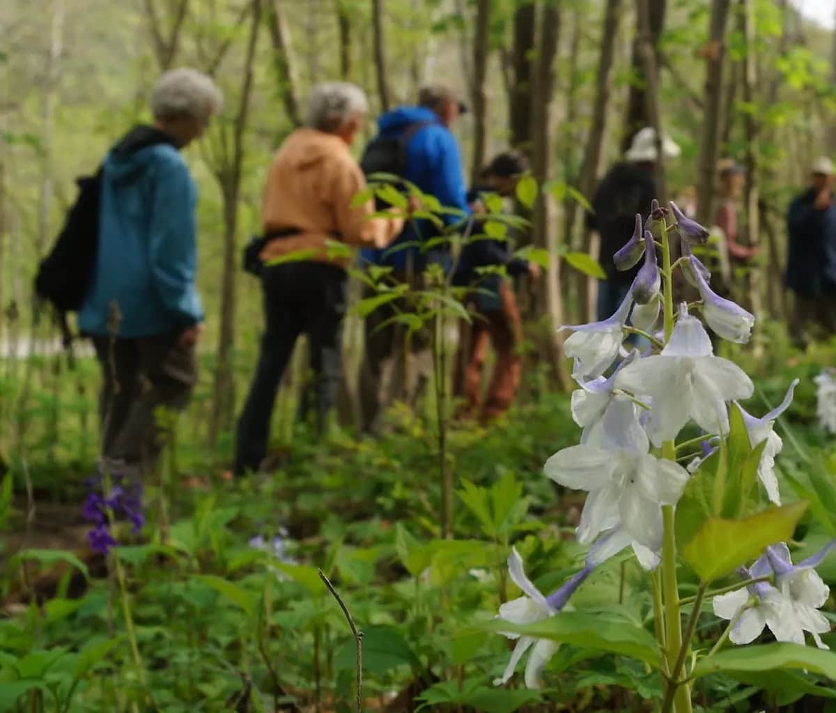
Join Cincinnati Off-Road Alliance (CORA), The Hillside Trust, and Green Umbrella’s Greenspace Alliance for the Meet A Greenspace Hike at Goltra Preserve on Thursday, June 11, from 3-4:30 PM.

Shaped by Glaciers

Nestled among the Ohio River Valley’s rolling terrain is our vibrant city of Cincinnati. For thousands of years, people have made this region their home, adapting to its steep and hilly landscape. Known as the “City of Seven Hills”, Cincinnati’s hillsides are our most iconic feature. But they are also one of our most vulnerable.

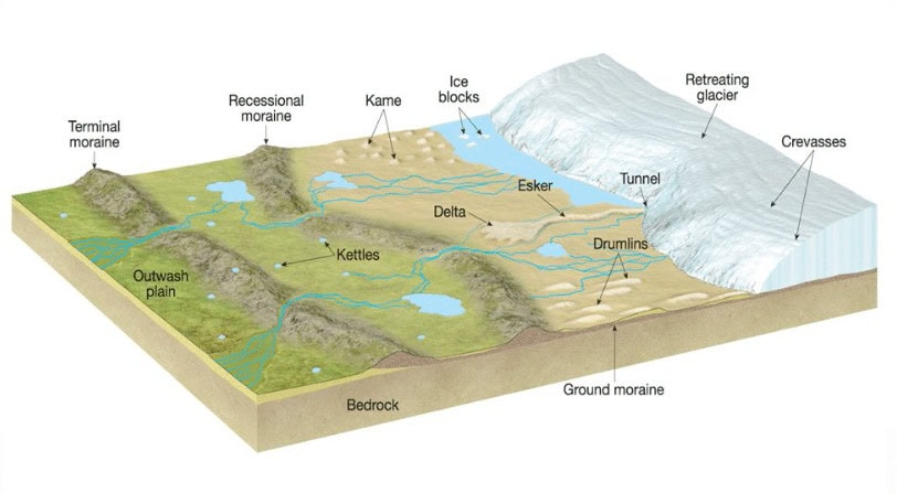
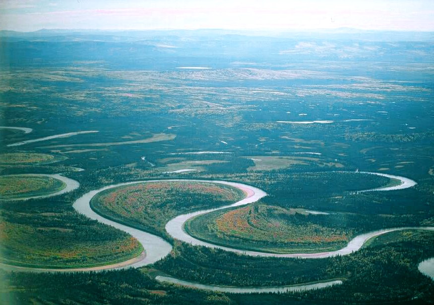
During the Pleistocene Ice Age, glaciers and their snowmelt flowed across the continent, sculpting the river valleys and hillsides that now define our region. It’s easy to assume that a landscape forged by such forces would be resilient, but in reality, our hillsides are surprisingly fragile and susceptible to natural disasters like landslides.

Source: Laure Quinlivan

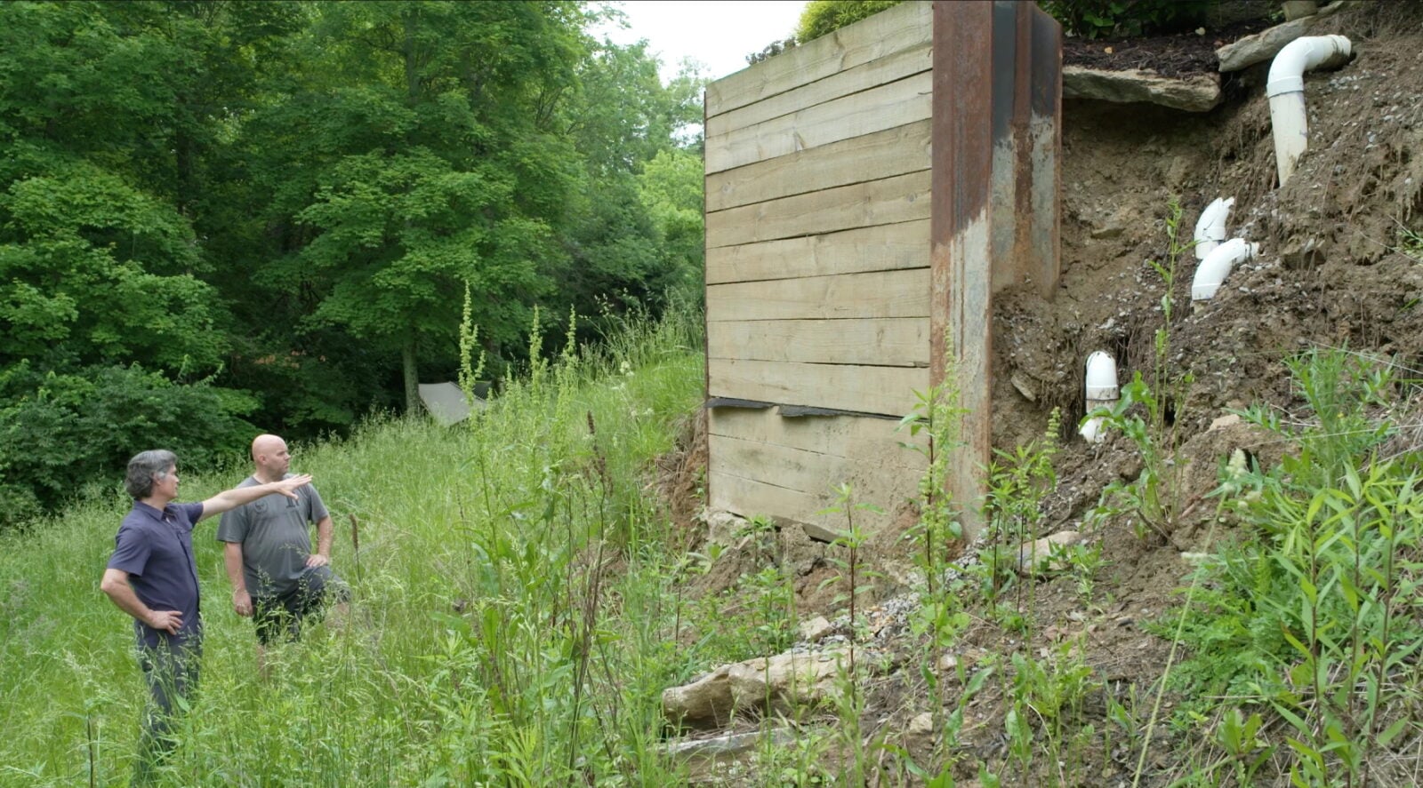
As the population grew, so did the need for land to build on. As a result, many set their sights on the ridgetops. The picturesque views of the river valley and the sloping hills beyond the water’s edge made those locations appealing to people. To build on these hills, trees and other vegetation were removed. This process exposed the rocks and sediment that were deposited and compacted by glaciation. The minerals in these rock and sediment deposits get weaker when exposed, especially to water, and eventually become mud. As mud builds up on hillsides, it tends to fall in what is known as a landslide.

According to a 2022 news article by WVXU, the City of Cincinnati has spent $113,949,097 repairing landslide-damaged roads and retaining walls since 1989. A cost that has most likely increased over the past four years.

Partnerships Protecting Hillsides

The Hillside Trust is an organization that advocates for the thoughtful use of our hillsides. Much of their work focuses on consulting with municipalities and government planning commissions on regulations that impact hillside development and preservation. They support long-range planning efforts in communities, help create and pass ordinances for view protection, and, among many other things, work with private landowners, especially those on hillsides, to protect their land for present and future generations to enjoy.

Source: CORA

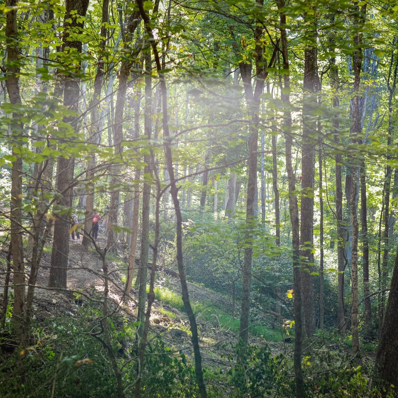
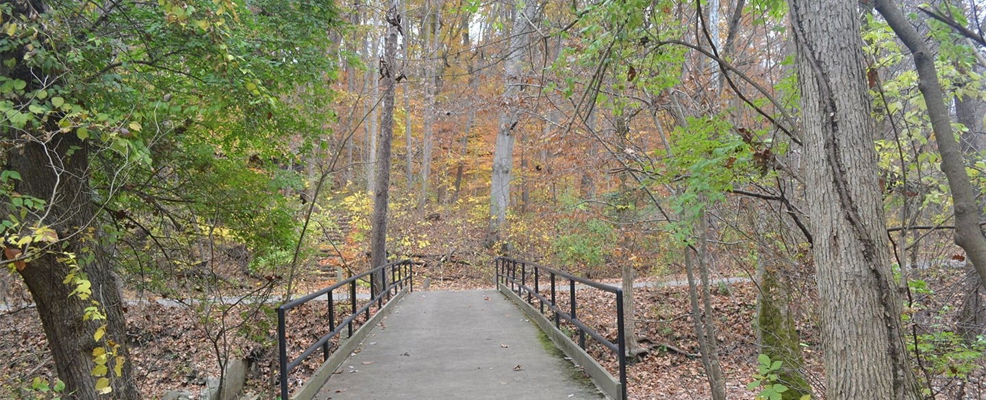
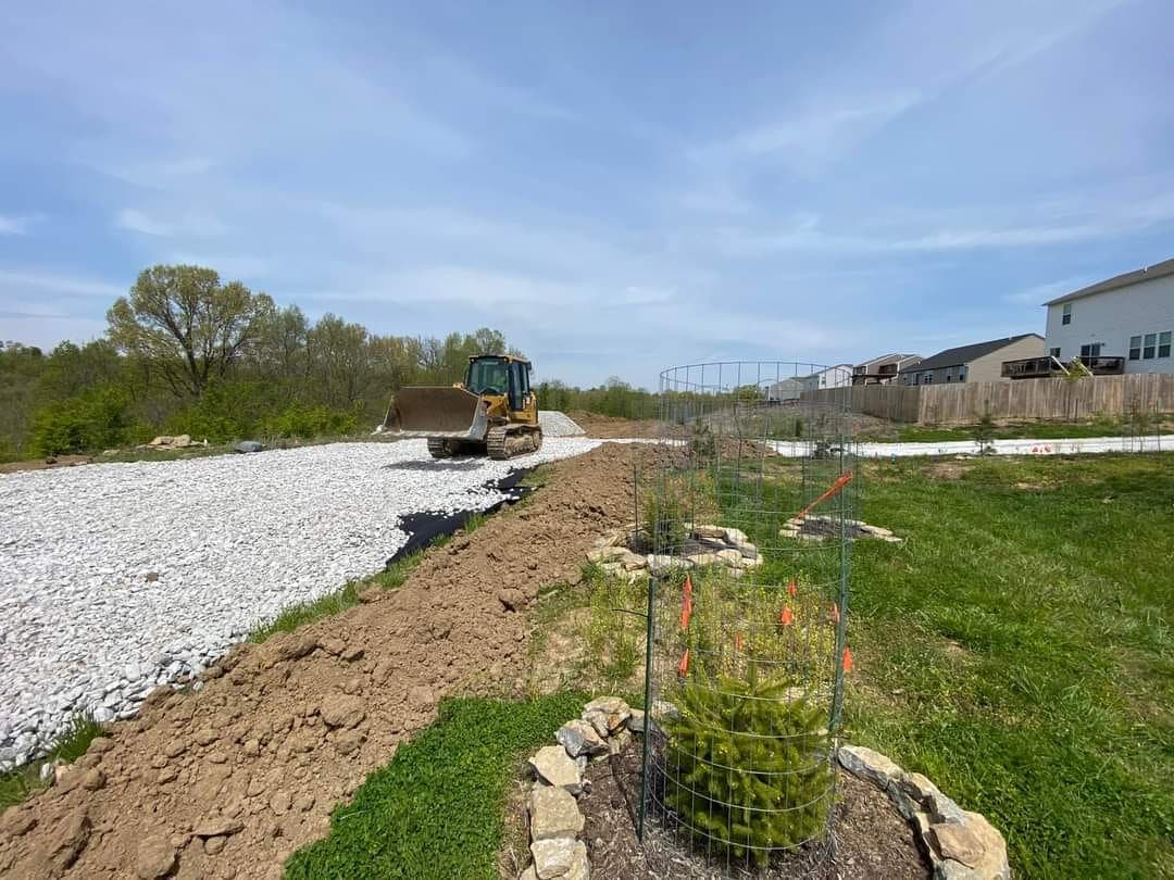
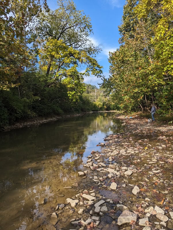
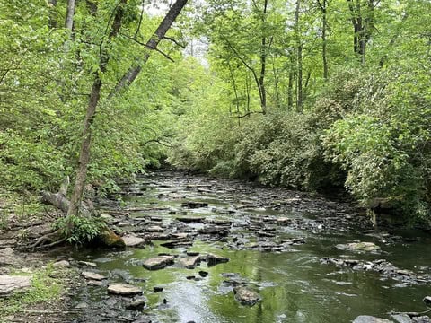
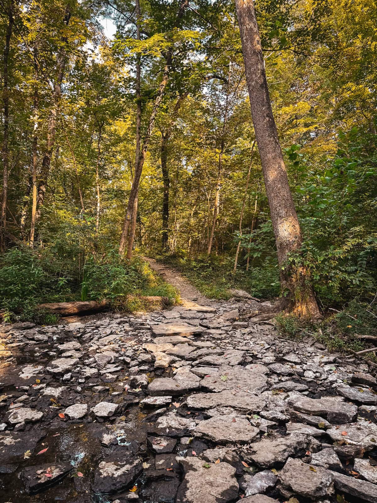
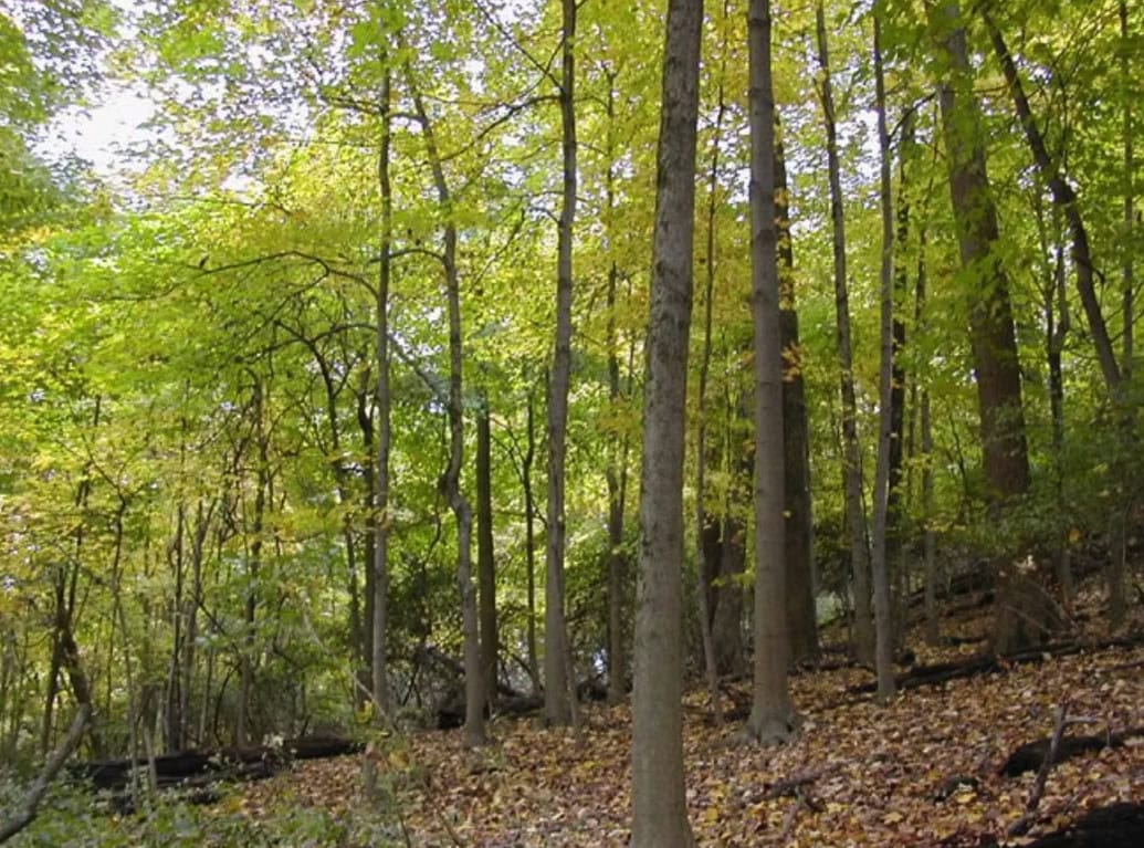
Goltra Preserve is one of the hillsides protected in perpetuity by The Hillside Trust. Its 67.94 acres were pieced together over decades, beginning with a 14-acre donation by David and Phyllis Goltra in 1986, followed by a 36-acre donation from J-II Homes in 2007, and the final 17.94 acres purchased in 2016. The Preserve features ridgetops and hillsides with mature trees, along with a multi-modal trail system designed, implemented, and maintained by the Cincinnati Off-Road Alliance (CORA). CORA is a non-profit organization dedicated to bringing a sustainable, world-class trail system to Greater Cincinnati, aiming to build 375 miles of trail by 2030. 

The partnership between The Hillside Trust and CORA has enabled the Goltra Preserve to be accessible to the public for a variety of activities, including mountain biking, e-biking, adaptive biking, hiking, and trail running.

Cincinnati Climate Week

This event is a part of Cincinnati’s inaugural Climate Week, happening from June 8-14! Presented by Green Umbrella with the Climate Week Network – a global initiative supporting cities as they launch and scale Climate Weeks. This decentralized week invites organizations throughout the region to host in-person and virtual events that spotlight local solutions, share expertise, and inspire a more resilient future. 

With extreme weather conditions becoming more prominent throughout the globe, the Midwest is predicted to experience an influx in population due to climate migration – the forced or voluntary movement of people due to sudden or gradual environmental changes such as sea level rise or increased prevalence of wildfire.

As people move inland, communities like Cincinnati will continue to face forces both natural and man-made as climate and populations shift. This makes the work of and partnerships between organizations such as The Hillside Trust and CORA that much more important! Not only will the pressures to develop hillsides continue, but so will the need for protected greenspace and accessible trail systems that enable individuals to explore the natural wonders of the region.

Explore Goltra Preserve!

We hope you’ll join us for a family-friendly outing at our upcoming Meet A Greenspace Hike at Goltra Preserve! The hike will take place on Thursday, June 11, from 3-4:30 PM and will be guided by CORA and The Hillside Trust Staff. We will meet at the Goltra Preserve trailhead located off Brokaw Avenue (2395 Brokaw Avenue, Cincinnati, OH 45225). Individuals of all ages are welcome!

This hike is part of our monthly Meet a Greenspace Hiking series. We hope these hikes will provide those who join the time and space they need to reconnect with nature and with one another. If you have any questions, contact Green Umbrella’s Greenspace Alliance Manager Claire Carlson at claire@greenumbrella.org. 

The Greenspace Alliance would like to thank its sponsor, Duke Energy, for making this hiking series possible!

Filed Under: Greenspace Alliance, Meet A Greenspace Hike Series

Spring Ephemeral Hiking Series

March 12, 2026 by Claire Carlson

During a short window of time in the early days of spring, tiny woodland flowers burst through the barren forest floor to catch rays of sunlight. These teeny flowers, whose lifespan covers only a few weeks, are called spring ephemerals and can be found right here in Cincinnati!

Join the Green Umbrella’s Greenspace Alliance, along with Western Wildlife Corridor and Cincinnati Parks, for a two-part Meet A Greenspace Hiking series to witness the beauty of the spring ephemeral!

  • Spring Ephemeral Series Part One at Buckeye Trace Nature Preserve, Thursday, March 26, from 3-4:30 PM
  • Spring Ephemeral Series Part Two at California Woods Nature Preserve, Friday, April 3, from 3-4:30 PM
Buckeye Trace Nature Preserve | Source: Western Wildlife Corridor

The Fast Life

In the springtime, sunbeams cascade through barren branches to the forest floor below, slowly warming the soil that still holds traces of winter snow. Before the shadows of the forest’s canopy block out the light, there is a short, yet sweet, time when small wildflowers known as “spring ephemerals” bloom. These flowers quickly emerge in the spring and remain only briefly, taking advantage of the open forest floor before woody plants and debris return. Once their short window passes, they die and return to their underground parts until the next year.

The Ephemerals of Cincinnati

Woodlands full of deciduous hardwoods—like maples, elms, and oaks—cover much of the tri-state area. The word “deciduous” comes from the Latin decidere, meaning “to fall off” and references these trees’ seasonal shedding of leaves. This annual leaf drop creates the perfect conditions for spring ephemerals to thrive.

Although there are many places to spot these fleeting flowers, this hiking series will focus on two special locations. Our first hike will be at the Buckeye Trace Nature Preserve on Cincinnati’s west side, where volunteer restoration has brought back a spectacular display of spring wildflowers. One week later, we’ll explore California Woods on the city’s east side. With the right timing, you may find pockets of this preserve covered in a dazzling array of tiny woodland blooms.

California Woods | Source: Cincinnati Parks

Experience the Ephemerals!

We hope you’ll join us at our upcoming Meet A Greenspace Hikes at Buckeye Trace and California Woods!

The hike at Buckeye Trace Preserve will take place on Thursday, March 26, from 3:00-4:30 PM, guided by staff from Western Wildlife Corridor. Parking for this hike is located in a gravel parking lot on site at 6438-6466 Hillside Ave., Cincinnati, Ohio, 45233. (Note: the driveway to this preserve is located between two privately owned residences, with it seeming to traverse into their backyard before hooking a left, down a brief and narrow gravel drive to the parking area).

The hike at California Woods will take place on Friday, April 3, from 3-4:30 PM, guided by Cincinnati Park staff. Parking for this hike is available inside the preserve, located at 5400 Kellogg Ave., Cincinnati, OH 45230. We will meet near the Nature Center located at the end of the driveway in the center of the park. (Please drive carefully on the one-lane, two-way park road and park at the end of the park road in the parking lot).

These hikes are part of our monthly Meet a Greenspace Hiking series. We hope this opportunity will provide those who join the time and space they need to reconnect with nature. If you have any questions, contact Green Umbrella’s Greenspace Alliance Manager Claire Carlson at claire@greenumbrella.org.

Filed Under: Greenspace Alliance, Meet A Greenspace Hike Series

An Oasis within the Sprawl

February 5, 2026 by Krystal Gallagher

Contributors: Claire Carlson, Nicole Clements

Nestled in a valley between subdivisions and a railroad, Brushy Fork Nature Preserve stands as a testament to the power of vision and collaboration. Join us for this month’s hike and explore the oasis between the sprawl!

Join the Banklick Watershed Council and Green Umbrella’s Greenspace Alliance for the Meet A Greenspace Hike at Brushy Fork Nature Preserve on Friday, February 20th, from 3-4:30 PM.

When Fate Intervenes

Graphic source: Banklick Watershed Council

In Northern Kentucky, suburban development has become increasingly common. Hillsides are cleared, ridges leveled, and sediment fills the valleys, covering streams, destroying habitats, and disrupting local ecosystems. Fortunately, fate had something different in store for Brushy Fork Nature Preserve.

Located in the heart of suburbia, this 104-acre property offers a rare retreat into natural beauty. This nature preserve features wetlands, forested hillsides, and Brushy Fork Creek, a tributary of Banklick Creek and the Ohio River.

The land was originally slated for subdivision development, but in the early 2000s, the Banklick Watershed Council met with the developer to discuss the potential ecological impacts. Although the land was not preserved at that time, the meeting helped establish a lasting relationship with the owners and laid the groundwork for future conservation efforts.

In 2014, the Banklick Watershed Council (BWC) successfully purchased the first section of the nature preserve along Brushy Fork Creek, which had already been protected as a conservation easement. While this was a huge win, the BWC knew that much of the land was still at risk. In early 2019, BWC received a call asking if they were still interested in purchasing the remaining part of the property. Due to a series of fortunate circumstances, they were able to acquire the land within the year!

Graphic source: Banklick Watershed Council

Shifts and Returns

Graphic source: Banklick Watershed Council

Stepping onto the property, it is easy to feel as though you have been transported elsewhere. As you descend the sloping hillside into the valley below, noises from the outside world fade into the background. During the warmer months, families from nearby communities enjoy taking a dip in the creek, hunting for fossils, or having a picnic along the banks. Old-growth trees tower overhead, while spring ephemerals cover the forest floor as winter warms to spring.

Although Brushy Fork is now preserved in perpetuity, the landscape shows marks from past changes. Years ago, Banklick Creek was rerouted, dramatically changing the area’s ecosystem. At a lookout point along the northwest edge of the property near the railroad tracks, visitors can see a picturesque view of the creek. A closer look, however, reveals eroding hillsides—evidence of the lack of access to its natural floodplain. The site is a good case study on the dramatic changes that can occur in a natural system when a stream is rerouted.

Even with these drastic changes, the Banklick Watershed Council and its many partners are working to protect this hidden paradise and revive the natural systems that previously existed here.

Explore Brushy Fork!

We hope you’ll join us at our upcoming Meet A Greenspace Hike at Brushy Fork Nature Preserve! The hike will take place on Friday, February 20th, from 3-4:30 PM and will be guided by the Banklick Watershed Council. We will meet at 10463 Canberra Dr., Independence, KY 41051. Pull down the gravel driveway, and you will find a parking lot behind the houses. If parking is full, you may park on the street – please do not block residents’ driveways. Note: these are undeveloped trails and are rough/steep in places. Trails may be muddy, so please wear appropriate footwear.

This hike is part of our monthly Meet a Greenspace Hiking series. We hope these hikes will provide those who join the time and space they need to reconnect with nature. If you have any questions, contact Green Umbrella’s Greenspace Alliance Manager Claire Carlson at claire@greenumbrella.org.

The Greenspace Alliance would like to thank its sponsors, Duke Energy and the Cincinnati Wildflower Preservation Society, for making this hiking series possible!

Filed Under: Greenspace Alliance, Meet A Greenspace Hike Series

From Village to Golf Course to Park: The History of Shawnee Lookout

January 15, 2026 by Claire Carlson

Pull on your warmest jacket, step into your sturdiest boots, and join us for a winter hike at Shawnee Lookout! This month’s hike is an opportunity to emerge from your den and experience one of the largest and continuously occupied sites in the country.

Join Great Parks of Hamilton County and Green Umbrella’s Greenspace Alliance for the Meet A Greenspace Hike at Shawnee Lookout on Friday, January 23, from 3-4:30 PM.

Before the Advent of Golf

Long before the slopes of North Bend, Ohio, were seeded with turfgrass and putting greens and filled with the sounds of motorized golf carts and shouts of “Fooooour!,” the area was home to various Indigenous peoples. For over 10,000 years, Native Americans built homes, established villages, and created mounds that stretched along the ridgeline, perched above the sprawling and braided Ohiyo—theSeneca word for “Great River.” The combination of river bottoms and hillsides made Shawnee Lookout an attractive site for prehistoric settlement. This advantageous geography undoubtedly contributed to its status as one of the largest and most continuously occupied hilltop sites in the United States.

Daylighting

After the golf course closed in 2019, the site was acquired by Great Parks of Hamilton County. The staff immediately began restoring the native seed bank and removing invasive honeysuckle, gradually unveiling the area’s history with each new sprout and cleared thicket. The most recent effort to recover the past is a comprehensive stream restoration project. Beneath layers of sediment and underground culverts lie streams that once sustained the region’s peoples. Now, through a collaborative initiative between Great Parks and The Nature Conservancy, work is underway to restore these waterways in a process known as “daylighting.” Restoration began in the spring of 2025 with the removal of culverts and asphalt that had covered the streams, followed by the creation of riffles and pools. Invasive plants will be removed, and 24,000 native trees and shrubs will be planted throughout the park. These efforts will enhance habitat for birds and other wildlife, provide shade for the stream, and improve water retention. Additionally, a new two-mile natural surface trail will replace the former cart path, honoring the land’s history as both a sustainer of life and a site for recreation.

Explore Shawnee Lookout!

We hope you’ll join us at our upcoming Meet A Greenspace Hike at Shawnee Lookout! The hike will take place on Friday, January 23, from 3-4:30 PM and will be guided by Great Parks of Hamilton County Staff. We will meet in the parking lot by the former clubhouse, located at 2008 Lawrenceburg Road, North Bend, OH, 45052. 

This hike is part of our monthly Meet a Greenspace Hiking series. We hope these hikes will provide those who join the time and space they need to reconnect with nature. If you have any questions, contact Green Umbrella’s Greenspace Alliance Manager Claire Carlson at claire@greenumbrella.org. 

The Greenspace Alliance would like to thank its sponsors, Duke Energy and the Cincinnati Wildflower Preservation Society, for making this hiking series possible!

Filed Under: Greenspace Alliance, Meet A Greenspace Hike Series

A Tale as Old as a Glacier

November 25, 2025 by Claire Carlson

Contributors: Claire Carlson, Boone County Park District

Forged by scouring ice and rushing water, Boone Cliffs is a memento of the past subdued by the present. Located in Burlington, Kentucky, the landscape offers a peek into the processes that shape our landscapes.

Join the Boone County Park District and Green Umbrella’s Greenspace Alliance for the Meet A Greenspace Hike at Boone Cliffs on Friday, December 5th, from 3:00-4:30 PM.

Present Day

Image source: NKyTribune

Covering 75 acres of Boone County, Kentucky, the Boone Cliffs State Nature Preserve is one of the most unique and natural areas in the region. The conglomerate cliffs that encircle the valley are the most notable feature of the preserve. Additionally, the trees, while likely selectively cut in the past, were never heavily logged or grazed, offering a prime example of a mature, mesic forest. This habitat type is characterized by its ability to provide a relatively constant moisture content during crucial growing periods. As a result, Boone Cliffs remains a prime example of a mature forest in the Greater Cincinnati Region.

A Peek into the Past

Boone Cliffs began to form some 700,000 years ago, when the Kansan ice sheet began to recede. During this period of thaw, the sediment and gravel accumulated by the glacier were deposited and left in what is now known as the Boone Cliffs State Nature Preserve. Over time, this deposit of loose rock solidified and cemented together under pressure; exposed to the modern eye by a small tributary that eroded the deposit’s surface and revealed the large conglomerate cliff faces we see today.

The rocks at Boone Cliffs are different than those of the surrounding region. They are igneous (rocks formed by magma) or metamorphic (rocks that have transformed due to heat or pressure) in nature. These igneous and metamorphic deposits in an area where sedimentary rocks are typical are known as glacial erratics – or rocks that have been deposited in a location different from the one in which they were formed.

Additionally, the Kansan ice sheet also contributed to the creation of the Ohio River! During the same time period that the igneous and metamorphic rocks were deposited in the region, the ice sheet also blocked the Teays River system. This pre-glacial river drained much of the Ohio River watershed, but followed a more northerly downstream course than our present one. As this happened, the river rerouted and formed the modern-day and westward-flowing Ohio River.

Graphic source: Glacial Landforms: Erosional and Depositional

Explore the Boone Cliffs!

Join the Boone County Park District and Greenspace Alliance in exploring this geologic masterpiece! The hike will take place on Friday, December 5, from 3:00-4:30 PM at Boone Cliffs and will be guided by Boone County Parks Staff. Due to limited parking at the Boone Cliffs site, we will be meeting at the Middle Creek Park parking lot (5655 Burlington Pike, Burlington, KY 41005) from which we will carpool to the Cliffs with the Park District.

This hike is part of our monthly Meet a Greenspace Hiking series. We hope these hikes will provide those who join the time and space they need to reconnect with nature, themselves, and others. If you have any questions, contact Green Umbrella’s Greenspace Alliance Manager Claire Carlson at claire@greenumbrella.org.

Filed Under: Meet A Greenspace Hike Series

Meandering: A Tale of the Oxbow Nature Conservancy

October 8, 2025 by Claire Carlson

Contributors: Claire Carlson, Sara Brandts

Have you ever meandered through a meander? Now’s your chance!

Join the Oxbow Nature Conservancy and Green Umbrella’s Greenspace Alliance for our hike at the Oxbow on Friday, October 24 from 3:00-4:30 PM.

What in the world is an Oxbow?!

Image source: Oxbow lake – Wikipedia

Tucked away between I-275 and the Ohio River lies an environmentally significant feature called ‘the oxbow’. Initiated by the meandering of a stream, river, or creek, oxbows form as a portion of a meandering body of water separates itself from the main stem of the water body. In this way, it is similar to tying a knot: after creating a loop with one end of the string over another and pulling both ends tight to form a knot, the once-straight string now features a bulge. Now, imagine that with a river, but the knot is cut off from the main stem of the stream. That is an oxbow: a separate water body that was once a part of a larger one.

40 Years of Protection!

40 years ago, in 1985, plans for the development of a barge port along the Ohio River were announced. The proposed development was for a piece of land where an oxbow had formed years ago from the meandering waters of the Ohio River. Because of the area’s importance as habitat for both local creatures and migratory birds, a group of concerned citizens came together and began a letter-writing campaign in an effort to stop the development of the barge port. They sought to increase awareness about the importance of the wetland habitat and its role as an annual stopover site for thousands of birds.

The concerned citizens were successful and the barge port development was stopped. But the citizens realized that this challenge was only the beginning, and they would continue to face similar challenges from entities interested in developing the area. They formed a land trust called Oxbow Nature Conservancy and began fundraising to purchase the site and protect it in perpetuity. Their initial purchase consisted of 30 acres where development pressures were consistent and ever-present. That 30-acre purchase has now expanded to 1,600 acres of protected riparian (river) corridor along the Ohio River. The land that Oxbow owns is contiguous, meaning it is all in one place and not scattered – a rarity among land conservancies.

A Peek Into the Oxbow

The land owned by the Oxbow Nature Conservancy is split into two sections, known as the east and west sides. The east side of the property is closed to the public and remains wild, allowing flora and fauna to grow and flourish uninterrupted by humans. At last count, 293 unique species of birds have been identified throughout the Oxbow, solidifying its significance as an important area for migratory birds.

The west side of the property is open to the public and features Oxbow Lake, Osprey Lake, and Mercer Pond. At certain points of the year, it is completely inaccessible due to flooding of the Ohio River. While many may view an event like this as catastrophic, it is actually life-giving for the oxbow. As the river floods its banks, water washes over the landscape where the oxbow lies, bringing with it fish and other aquatic creatures that will restock the lakes and ponds dotted throughout the floodplain. In addition to bringing life, the waters also provide needed nutrients to the soil and kill invasive plants present in the area, ensuring that the landscape remains fertile for generations to come. Historically, this landscape has been a protective measure for the community of Lawrenceburg, providing a barrier against Mother Nature’s whims.

Due to the fertile and productive soil of this area, it has also historically been a prime place for farmland, dating back to when Native American tribes lived undisturbed throughout the landscape. Due to the presence of Native peoples, the Archeological Research Institute conducts excavations of sites throughout the oxbow in search of artifacts.

Visit the Oxbow!

We hope you’ll join us for our upcoming hike with the Oxbow Nature Preserve! The hike will take place on Friday, October 24, from 3:00-4:30 PM, and will be guided by Oxbow staff and board members. We will meet in the upper parking lot area, which can be found in two ways: 

  • By going south on US Hwy 50 from the I-275 #16 exit. In ~200 yards, turn left (east) at the edge of the Circle K (between Circle K and the Waffle House) and go over the levee to where the road T’s with a fence directly in front of you. Turn right and go to the Oxbow entrance sign. Turn left into the Oxow. The upper parking area is immediately on the right.
  • Using Google Maps and searching for “Oxbow Nature Conservancy”

If we are lucky enough, we may be able to catch the tail end of the monarch butterfly migration!

This hike is part of our monthly Meet a Greenspace Hiking series. We hope these hikes will provide those who join the time and space they need to reconnect with nature. If you have any questions, contact Green Umbrella’s Greenspace Alliance Manager, Claire Carlson, at claire@greenumbrella.org.

Filed Under: Meet A Greenspace Hike Series

Landen-Deerfield Park

September 10, 2025 by Claire Carlson

Tucked away in the heart of the Landen-Maineville area lies a 95-acre hidden gem with connections to the Little Miami River, offering opportunities for mountain biking, outdoor recreation, and fishing. You won’t want to miss out on exploring this park!

Join the Warren County Park District, the Cincinnati Off-Road Alliance (CORA), and Green Umbrella’s Greenspace Alliance for the Meet A Greenspace Hike at Landen-Deerfield Park on Friday, September 19, from 3:00-4:30 pm.

A Community Hub

Image source: CORA

Landen-Deerfield Park lies in the heart of the Landen-Maineville area. The sprawling 95-acre park offers a variety of recreational options, including approximately two miles of hiking and mountain biking trails. The northern portion of the park is home to Simpson Creek, a local hidden gem. This area of the park offers nature enthusiasts the chance to escape bustling suburbia and settle into a serene space surrounded by babbling water and chirping birds. It is the perfect place to seek respite and reconnect with yourself and nature.

Work to restore the water features at the park is currently underway – read on to learn what is happening!

Re-imagining Waterways through Restoration

Image source: Warren County Park District

The Warren County Park District is the recipient of a nearly $1 million investment focused on improving water quality, nature play and recreation, nature education, public safety, and long-term maintenance. Known as the Simpson Creek Headwaters Restoration Project, this investment will assist in restoring a tributary of the Little Miami River near Simpson Creek. This will also revitalize a beloved water feature, the Landen-Deerfield Park Pond, to a natural stream channel with wetlands and a pond system. These changes will help improve water quality in the Little Miami River Watershed.

The project, scheduled to begin in the latter half of 2025, is designed to establish natural waterways at the park by reducing the size of the pond. Historically, this pond never existed in this location and was created by the damming of a stream in the 1980s. While the pond is a popular spot for anglers today, it is an unhealthy water body due to its shallow depth, the depletion of oxygen from the growth of algae, duckweed, and watermill, and the subsequent influx of chemicals designed to “treat” the unwanted aquatic plant growth.

Long term, this project will be able to improve wildlife and fish habitats, establish natural streams, wetlands, and stream edges that will be more effective at removing pollutants from local waterways, increase accessibility for park-goers to interact with the water, and reduce downstream flooding risks and maintenance costs for the dam.

Reimaging Trails

Image source: CORA

One of Warren County Park District’s partners is the Cincinnati Off-Road Alliance (CORA). CORA was founded in the 1990s by a group of dedicated mountain bikers in Greater Cincinnati who had trouble finding trails for singletrack mountain bike use. CORA focuses on building and advocating for more miles of sustainable, off-road trails. Warren County Park District and CORA work together to provide community members with access to nature.

Today, CORA maintains over 115 miles of multi-use natural surface trails throughout the region, including 3.5 miles of trails at Landen-Deerfield Park.

Explore Landen-Deerfield Park!

Join us for this unique outdoor experience with the Warren County Park District! The hike will take place on Friday, September 19, from 3:00-4:30 pm at Landen-Deerfield Park and will be guided by Warren County Park District and CORA staff. We will meet at the Trailhead Shelter at the back of the park by the bit arch. The park’s address is 2258 US-22 in Maineville, OH, 45039.

This hike is part of our monthly Meet a Greenspace Hiking series. We hope these hikes will provide those who join the time and space they need to reconnect with nature. If you have any questions, contact Green Umbrella’s Greenspace Alliance Manager Claire Carlson at claire@greenumbrella.org.

Filed Under: Greenspace Alliance, Meet A Greenspace Hike Series

Scientists in the Wild

August 5, 2025 by Claire Carlson

Have you ever dreamed of meeting a scientist in real life? How about exploring a hidden greenspace? If either of these statements rings true to you, join the Greenspace Alliance, Cincinnati Parks, and the Center for Collaboration on Climate and Community for Health (C4H) for their Meet A Greenspace Hike at Badgley Run!

Join the Greenspace Alliance and C4H for this month’s Meet A Greenspace Hike on Friday, August 29, from 3:00-4:30 pm at Badgley Run in Cincinnati’s Northside Neighborhood.

Hidden Gems

Once slated for development as part of the I-74 expansion, Badgley Run is a 16-acre property owned and operated by the Cincinnati Park Board (CPB). Local community members successfully advocated for its protection. Initial funding acquired the original two parcels of land, and a comprehensive restoration initiative remediated extensive dumping, erosion, and invasive species on the site. The park is currently managed by Cincinnati Parks, along with Northside Greenspace Inc. and other regional stakeholders who are committed to improving the site.

To further highlight the success of this property, Badgley Run serves as an important greenspace corridor for both wildlife and residents. At the time of its initial purchase, Badgley Run aligned with the City of Cincinnati’s goal to link the Northside communities with nearby Mt. Airy Forest. Additionally, a property owned by The Hillside Trust, a non-profit dedicated to protecting the region’s hillsides, borders Badgley Run, further emphasizing its importance as a greenspace corridor.

C4H: Connecting Climate and Health in Cincinnati

The Cincinnati Center for Collaboration on Climate and Community for Health is a new research center under development at the University of Cincinnati. Often referred to as C4H, the Center will focus on understanding and reducing the health impacts of climate change on vulnerable populations, including first responders, outdoor workers, pregnant women, children, and senior citizens living in economically disadvantaged urban areas. As climate change continues to worsen, cities and the urban and suburban sprawl that forms around them will be subject to its impacts at higher levels. These communities often lack natural features like forests and native greenspaces that help mitigate the impacts from heat, air pollution, and storm events that are becoming more prevalent and extreme.

Leadership of the new Cincinnati Center for Climate and Health. Photo/Andrew Higley/UC Marketing + Brand. Seated from left to right: Kelly Brunst, PhD, Ardythe Morrow, PhD, MSc, George Leikauf, PhD, Michelle Burbage, PhD. Standing from left to right: David Stradling, PhD, Amit Bhattacharya, PhD, Angelico Mendy, MD, PhD, Shaunak Sastry, PhD, Patrick Ryan, PhD, MS.

This Meet A Greenspace Hike will connect participants with scientists working to protect human health in a changing climate. Representatives from C4H will share how their work impacts individuals on both regional and national scales. This hike will also offer hikers the opportunity to communicate concerns they have about the intersection of health and climate change.

Explore Badgley Run!

We hope you’ll join us at our upcoming hike with Cincinnati Parks and C4H! The hike will take place on Friday, August 29 from 3:00-4:30 pm. It will be guided by staff from Cincinnati Parks along with members of C4H. We will meet at the Badgley Rd. entrance, located at 4300 Badgley Rd., Cincinnati, OH 45223.

This hike is part of our monthly Meet a Greenspace Hiking series. We hope these hikes will provide the time and space they need to reconnect with nature. If you have any questions, contact Green Umbrella’s Greenspace Alliance Manager Claire Carlson at claire@greenumbrella.org.

Filed Under: Greenspace Alliance, Meet A Greenspace Hike Series, Uncategorized

Deep Space, Land Preservation, and…Orienteering?! Find them all in Warren County, Ohio!

July 14, 2025 by Claire Carlson

Contributors: Claire Carlson

Known as the “jewel of the Little Miami River Valley”, Hisey park is an oasis in southwest Ohio. Full of history, hiking trails, and even a Rocketry Association, this park has it all!

Join the Warren County Park District and Green Umbrella’s Greenspace Alliance for the Meet A Greenspace Hike at Hisey Park on Friday, July 18 from 3:00-4:30 p.m. Enjoy a meandering hike and an opportunity for solar viewing with the Warren County Astronomical Society at the Fred Bay Observatory in Hisey Park!

The Journey West

Graphic source

Like many families who came to America in the 17th century, the Hiseys traveled far and wide before settling in the Little Miami River Valley. Their journey began out east in Truro, Massachusetts, with stops in North Carolina and Kentucky, before moving to the new state of Ohio in the early 1800s. From 1809 to 1988, generations of the Hisey family farmed the land that would one day become Hisey Park. They planted corn, wheat, and soybeans, and raised livestock, including horses, sheep, hogs, and cattle. As the family grew, so did the farmhouse. It started as a small home made of logs and expanded into a two-story building where the last generations of the Hisey family lived before moving to a larger farm in Greenfield, Ohio in 1998.

To this day, the farmhouse remains on the property. Its simple frame and exterior is an ode to a different time; a time when cultivating the land and cultivating one’s family was of the utmost importance. While the house is not open to the public, the Warren County Park District uses it for various programs and events.

The Legacy of the Hisey Name

Graphic source

If the original members of the Hisey family were still alive today, their legacy might suprise them. Not only is the land they stewarded permanently protected, it is also home to and used by a number of organizations within Warren County.

Located near the house is a cylindrical structure appearing to stick out of the ground. Its silver color and corrugated surface looks like a standard grain silo – a typical feature of a farmyard. However, this structure holds no grain and is a special silo known as the Fred Bay Observatory. The Observatory features a 9-inch refracting telescope that allows visitors to view the solar system’s planets and deep-space phenomena like galaxies, nebulas, clusters, and stars. During the hike on July 18, the Warren County Astronomical Society (WCAS) will open the Observatory and provide solar viewing to hike participants!

In addition to WCAS, representatives from Friends of Warren County Park District and Orienteering Cincinnati will be joining us for the hike! Meet A Greenspace Hikes are designed with this type of connection-building in mind, and hiking with us will help you learn more about what each of these organizations do and how you can get involved!

Explore Hisey Park!

Join us for this unique outdoor experience with the Warren County Park District! The hike will take place on Friday, July 18 from 3:00-4:30 pm at Hisey Park and will be guided by Warren County Park District Staff. We will meet at the picnic shelter off of the parking lot at 5443 Middletown Road, Corwin, OH 45068.

This hike is part of our monthly Meet a Greenspace Hiking series. We hope these hikes will provide those who join the time and space they need to reconnect with nature. If you have any questions, contact Green Umbrella’s Greenspace Alliance Manager Claire Carlson at claire@greenumbrella.org.

Filed Under: Greenspace Alliance, Meet A Greenspace Hike Series

Building Trails to Foster Community

June 2, 2025 by Claire Carlson

Contributors: Claire Carlson, Jaki Howser

Situated on the southern edge of Dayton, Kentucky, this greenspace has been transformed into a multi-purpose, natural-use trail system for the community.

Join the Cincinnati Off-Road Alliance (CORA) and Green Umbrella’s Greenspace Alliance for the Meet A Greenspace Hike with CORA on Friday, June 20th, from 3:00-4:30 PM.

Sargeant Park: A Brief History

For a number of years, Sargeant Park in southern Dayton, Kentucky was reclaimed by nature. Plants, invasive and otherwise, grew tall and thick, overtaking much of the forest floor. Woodland creatures made homes in the 40 acres of overgrown trees and plentiful vegetation. Some species, however, did not thrive. As the Emerald Ash Borer beetle left a trail of destruction in its sweep across the country, the once-plentiful ash tree deteriorated, died, and fell in Sargeant Park. Beginning in the early 2020s, the City of Dayton and its Park Board began the process of restoring this park to breathe new life into it. This work has continued over the past four years, with the park recently being reopened for public use and enjoyment.

Reimagining Trails

A main partner in this work to reinvigorate and reimagine a community with an accessible and usable Sargeant Park is the Cincinnati Off-Road Alliance (CORA). CORA is a non-profit organization focused on building and advocating for more miles of sustainable, off-road trails.

Today, CORA maintains over 115 miles of multi-use natural surface trails throughout the region, including those at Sargeant Park. They began trail construction at the park in the fall of 2024 and wrapped up construction in the spring of 2025. CORA and its partners at the City of Dayton, the Dayton Park Board, Groundwork Ohio River Valley, Northern Kentucky University, and countless volunteers have poured hours of labor and dedication into transforming this once forgotten and neglected space into a place to be enjoyed by the community.

Explore Sargeant Park!

CORA’s dedication to providing accessible and sustainable trails for all is truly exemplified by its work in Sargeant Park. We hope you will be able to join us in celebrating their hard work by getting out and exploring the newly developed trail system! The hike will take place on Friday, June 20, from 3:00-4:30 PM at the Sargeant Park and will be guided by CORA staff. We will meet in the parking lot at 999 Covert Run Pike, Dayton, KY, 41074.

This hike is part of our monthly Meet a Greenspace Hiking series. We hope these hikes will provide those who join the time and space they need to reconnect with nature. If you have any questions, contact Green Umbrella’s Greenspace Alliance Manager Claire Carlson at claire@greenumbrella.org.

Filed Under: Greenspace Alliance, Meet A Greenspace Hike Series

“Grossly Polluted” to Revitalized: Visit the Mill Creek

April 1, 2025 by Claire Carlson

Contributors: Claire Carlson, Beth Himburg

Once a thriving waterway, then being polluted by humans and labeled “the most endangered urban river in North America”, then restoring it to a healthy water body, there have been many transitions throughout the life of Mill Creek. Come and explore one of the largest stream restoration projects in SW Ohio!

Join the Mill Creek Alliance and Green Umbrella’s Greenspace Alliance for the Meet a Greenspace Hike with Mill Creek Alliance on Friday, April 18 from 3:00-4:30 p.m.

A Journey Through the Waters of Time

Originally called the Maketewa by the Shawnee peoples who called this region home, the creek was once a source of sustenance. By the late 1700s, settlers began to arrive, renaming the waters Mill Creek, and in 1791 the first mill was constructed along the creek in Northside. As the population expanded and the Industrial Revolution boomed, bridges were built, canals dug, and sewage began being dumped into the Creek. As human growth pushed forward, wildlife in the creek waters disappeared, and factory and sewer waste transformed the once clean water into a “grossly polluted” waterbody that could no longer sustain life. During the Green Revolution of the early 1970s and subsequent introduction of the Clean Water Act, industries began to stop discharging waste into the Creek. Projects including the Rivers Unlimited Mill Creek Restoration Project and newly formed groups like the Mill Creek Watershed Council and the Mill Creek Yacht Club began their revitalization efforts in the mid to late 1990s, laying the foundation for what the Mill Creek Alliance is today.

The Healing Journey

Over the past 25+ years, the Mill Creek Alliance has worked to revitalize these waters to their once pristine state. They have implemented nearly 30 major restoration projects, with one of the largest being their Twin Creek Wetland Enhancement Project.

Graphic source: Mill Creek Alliance

Installed in 2012, the Twin Creek Preserve (TCP) Project set out to achieve full water quality attainment with Warm Water Habitat Aquatic Life Standards. These standards are designed to protect productive warm water aquatic communities, fowl, animal wildlife, arboreous growth, and agricultural and industrial use. Adherence or nonadherence to these standards is based on how much pollution is discharged into a water body. To achieve these standards, restoration on segments of the Mill Creek mainstem and East Fork Mill Creek needed to be employed.

The 5-acre Twin Creek Preserve wetland was designed to have flow from both the Mill Creek and East Fork Mill Creek whenever each stream increased in elevation. When this happens, excess water will be stored and filtered through the vegetation planted in the wetland, rather than continuing downstream. Wetlands serve important functions in an ecosystem, trapping and slowly releasing surface water, rain, snowmelt, and flood waters, reducing flood heights and erosion. Additionally, because of the numerous plants that reside in wetlands, they can enhance water quality by filtering out pollutants.

A few years after the project was completed, Twin Creek Preserve was listed as an “eBird Hotspot” in Ohio, as wetland birds such as herons, ducks, geese, and osprey frequent the lush area. Additionally, sampling done by the Midwest Biodiversity Institute has indicated large improvements in the water, biological, and habitat quality.

Explore the Mill Creek!

The Mill Creek Alliance has worked tirelessly for the past 25 years to bring life back to this once-thriving creek. We hope you’ll join us in celebrating and experiencing these accomplishments at our upcoming hike with Mill Creek Alliance! The hike will take place on Friday, April 18 from 3:00-4:30 pm at the Twin Creek Preserve and will be guided by Mill Creek Alliance staff. We will meet in the parking lot at 12033 Best Place, Sharonville, OH 45241.

This hike is part of our monthly Meet a Greenspace Hiking series. We hope these hikes will provide those who join the time and space they need to reconnect with nature. If you have any questions, contact Green Umbrella’s Greenspace Alliance Manager Claire Carlson at claire@greenumbrella.org.

Filed Under: Greenspace Alliance, Meet A Greenspace Hike Series

Urban Cows, Regenerative Agriculture, and Good Ol’ Hiking Trails

March 18, 2025 by Claire Carlson

Contributors: Claire Carlson, Jack Stenger

Have you ever met an urban cow? They are just like any other cow, except they live within city limits and enjoy beautiful views of downtown. If you’re curious to learn more about urban cows and the farm they call home, keep reading.

Join Cardinal Land Conservancy and Green Umbrella’s Greenspace Alliance for their collaborative hike at Bahr Farm and Winton Preserve on Friday, March 21 from 3-4:30 PM.

The Story of Bahr Farm and Winton Preserve

Tucked away in Northside is Bahr Farm, a 39-acre property purchased by the Bahr Family in 1916. In 2021, the Bahr Family generously gifted the farm to Cardinal Land Conservancy in exchange for permanent protection from development, which resulted in a win for the family and the creation of the Conservancy’s first working farm. Fun fact: The barn on the property was built in the early 1800s, making it the oldest barn in Hamilton County!

The working farm is home to a small number of urban cattle and Our Harvest Cooperative. The cattle are spend their time grazing on the mix of pollinator-friendly plants throughout the property, which serves as their main feed source. Our Harvest Cooperative, a local Community Supported Agriculture (CSA) and member of Co-Op Cincy, occupies 6 acres near the front of the property. The organization’s mission is to ensure that Cincinnatians have fresh, easy-to-access food grown by fairly compensated workers. If you’re interested in Our Harvest, want to join their CSA, or want to support their work, check out their website.

Bahr Farm is connected to Winton Preserve, a 19-acre wooded area east of the farm and owned by Cardinal Land Conservancy. Winton Preserve contains native trees and vegetation restored to its natural state after extensive invasive honeysuckle removal. The Cardinal Land Conservancy is working in this space to establish a trail system for public use.

Bahr Farm’s Future

Cardinal Land Conservancy plans to turn Bahr Farm and Winton Preserve into its flagship property and open it up to the community so they can learn more about urban agriculture and restoration practices. Additionally, the woods that make up the Preserve are part of a carbon credit program. This program enables individuals or companies to offset their carbon emissions by purchasing credits from an organization implementing environmental practices that directly contribute to carbon dioxide removal.

Visit Bahr Farm and Winton Preserve!

We hope you’ll join us for our upcoming hike with Cardinal Land Conservancy at their Bahr Farm and Winton Preserve properties! The hike will take place on Friday, March 21 from 3-4:30 PM, and will be guided by Cardinal Land Conservancy staff. We will meet in the parking lot at 973 W North Bend Rd., Cincinnati, OH.

This hike is part of our monthly Meet a Greenspace Hiking series. We hope these hikes will provide those who join the time and space they need to reconnect with nature. If you have any questions, contact Green Umbrella’s Greenspace Alliance Manager, Claire Carlson, at claire@greenumbrella.org.

Filed Under: Greenspace Alliance, Meet A Greenspace Hike Series

  • 1
  • 2
  • Next Page »
Green umbrella Logo
  • Careers

  • Contact

  • FAQs

stay connected

subscribe to our Newsletters
© 2026 Green Umbrella. All Rights Reserved.
Privacy Policy · Website by Wonderly.

Climate action makes communities healthier, more resilient, and better prepared for what’s ahead.

This is where you come in.

Every dollar contributed goes to driving climate action in the Greater Cincinnati region. Will you join us in making our community greener?

Donate Today!